



The English River remained above flood stage near Kalona Monday while Cedar Rapids and Marion assessed damage and the Rock River was forecast to flood near Moline.
By Hola America News
Updated and last verified Monday, Sept. 21, 2026, at 4 p.m. CDT.

EASTERN IOWA AND THE QUAD CITIES — River flooding remained a concern Monday across eastern Iowa and the Quad Cities even as the heaviest weekend rainfall moved out of the region.
The English River at Kalona remained well above flood stage Monday morning after reaching 18.6 feet overnight. Farther east, the Rock River at Moline was expected to rise above flood stage Monday evening and continue climbing into Tuesday.
Cedar Rapids and Marion were also assessing damage after several inches of weekend rain flooded streets, parks, trails and some basements. Cedar Rapids closed the Sac & Fox Trail until further notice, while Marion reported Monday that flash flooding was receding.
Light rain and drizzle remained possible Monday, but the larger concern had shifted from new flash flooding to runoff moving through rivers and creeks.


The English River at Kalona remained above flood stage Monday
The English River at Kalona measured 17.9 feet at 9 a.m. Monday, compared with a flood stage of 14 feet.
The river reached a maximum of 18.6 feet during the previous 24 hours and was falling Monday morning. The National Weather Service forecast the river to fall below flood stage shortly after midnight Monday night.

At around 18 feet, water overtops area roads including 130th Street, Kiwi Avenue, Orange Avenue and Poplar Avenue, and extensive agricultural flooding occurs near the river.
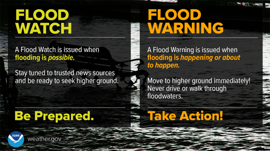
A Flood Warning remained active for the English River as water continued to move through the river system.
The Rock River at Moline could reach 13.2 feet Tuesday
The Rock River at Moline stood at 11.1 feet at 9:30 a.m. Monday. Flood stage is 12 feet.
The river was forecast to rise above flood stage Monday evening and crest near 13.2 feet Tuesday evening before falling below flood stage late Thursday.
At 13.2 feet, water can affect 60th Street south of John Deere Road, 56th Avenue near Green Valley Park and 48th Street, Canal Road on Big Island and Smith’s Island.
A Flood Warning for the Rock River at Moline was expected to remain in effect into Friday morning.
Cedar Rapids and Marion are assessing damage after weekend flooding
Weekend rainfall caused urban flooding in Cedar Rapids and Marion before conditions began improving Monday.
Sunday rainfall reports included 3.21 inches in Cedar Rapids and 3.11 inches in Marion. Marion received about 4.5 inches across Saturday and Sunday.
Cedar Rapids Parks and Recreation closed the Sac & Fox Trail until further notice after portions of the trail washed out and fallen trees blocked paths.
In Marion, the city turned off drainage pumps Monday as flash flooding receded and began assessing damage to public parks and trails. Flooding had affected Thomas Park and other low-lying areas during the weekend.
Marion residents with water-damaged items can request curbside collection through the city or call Public Works at 319-377-6367.
Davenport and the Quad Cities remain focused on rising rivers
Flash flooding also affected the Quad Cities during the weekend. River Drive near Howell Street in Davenport was closed Sunday after floodwater covered the roadway beneath the railroad bridge.
By Monday, the larger river threat in the immediate Quad Cities area was shifting toward the Rock River near Moline as runoff continued downstream.
The National Weather Service also warned that several rivers and creeks across eastern Iowa and western Illinois were experiencing significant rises or active flooding after the weekend rain.
Light rain continues before drier weather arrives
Scattered light showers and drizzle were expected to continue Monday into Tuesday morning. Additional rainfall totals were expected to remain below an inch across most of Iowa, reducing the risk of another widespread flash-flooding episode.
The additional rainfall could still slow improvement along rivers already carrying heavy runoff.
Drier conditions are expected Wednesday and Thursday before another chance of showers returns later in the week.
Current river warnings, forecasts and flood statements are available through the National Weather Service Quad Cities office.
Related: Flood watch expired Aug. 15 across Des Moines and Quad Cities
Flood conditions can change as runoff moves downstream. The National Weather Service advises motorists not to enter roads covered by water or drive around barricades.
Stay in the know with stories that matter — visit HolaAmericaNews.com for the latest news, culture and community updates!
Facebook Comments