




Severe storms possible tonight as extreme heat persists
By Isabelle Foland, Des Moines Register
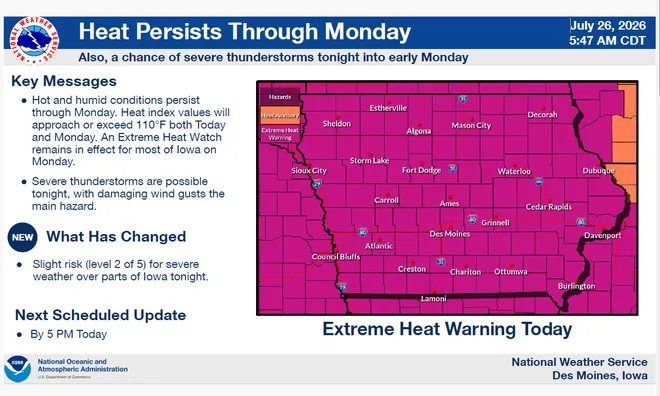
As heat indices of 110 degrees persist, severe storms are now in the forecast for the state from the evening of Sunday, July 26, to the early morning of Monday, July 27.

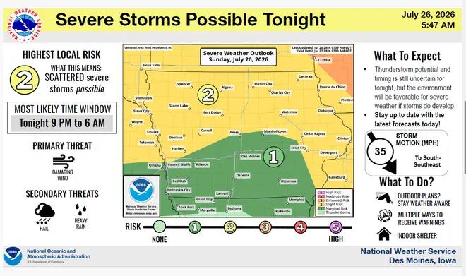
The National Weather Service predicts 9 p.m. to 6 a.m. as the most likely window for severe storms on Sunday night. The risk of storms is at a level two out of five for most of the upper half of the state. For the southern part of the state, including Des Moines, the risk is at a level one.

The main threat is strong winds, with chances of hail and heavy rain as well, according to the weather service. High temperatures will persist throughout Sunday and Monday, with Tuesday, July 28, cooling down a bit into the upper 90s.
To stay safe in the heat, the weather service recommends taking breaks from the outdoors in the air conditioning or shade, drinking lots of water and never leaving children or pets unattended inside vehicles.

Related story: Extreme heat in Iowa could continue into Fourth of July weekend.
Stay in the know with stories that matter — visit HolaAmericaNews.com for the latest news, culture, and community updates!

Facebook Comments